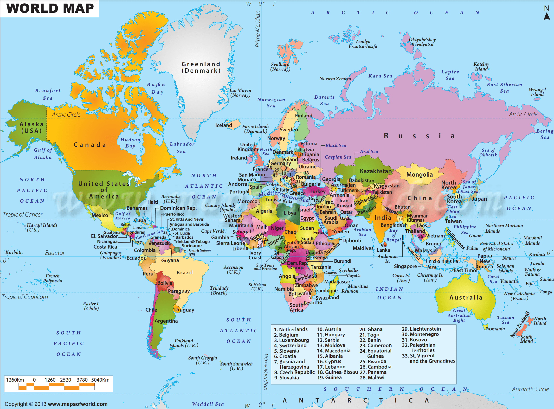
World Map with Countries and Capitals
The high-resolution world map below is a two-dimensional (flat) projection of the global landmass and oceans that cover the surface of our spherical planet. The world map shows the continents, oceans, major countries, and a network of lines representing meridians and parallels, the geographic coordinate system.
Download World Maps
Welcome to our treasure trove of high-quality, freely downloadable world maps! Whether you’re a student, traveler, educator, or researcher, these maps offer invaluable insights into our planet’s diverse landscapes, populations, and geographical features. Dive into this collection and unlock a wealth of knowledge at your fingertips.
Here are different world maps in high-resolution vector format which you can download based on your requirements.
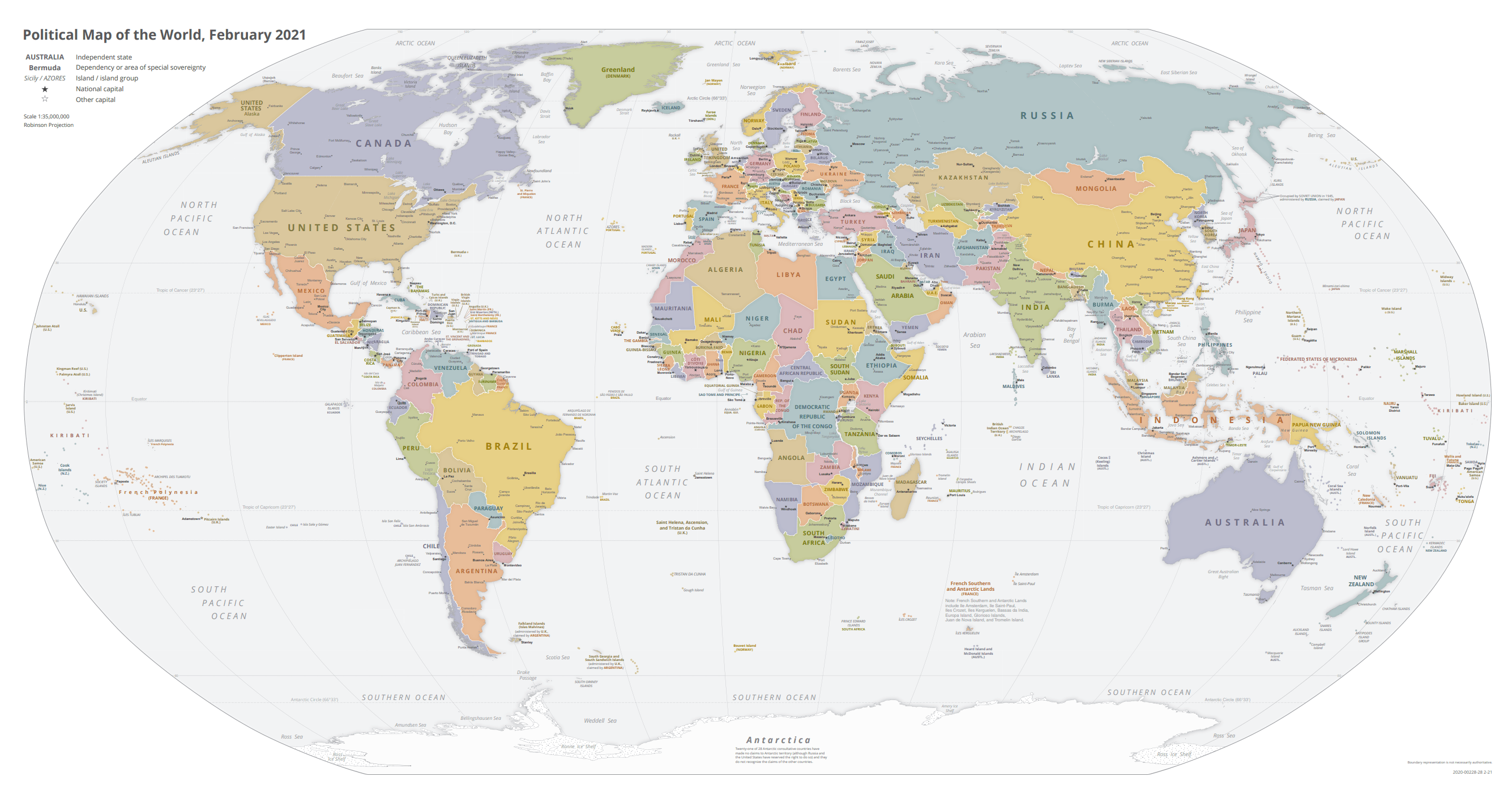
Political Map of the World, November 2021
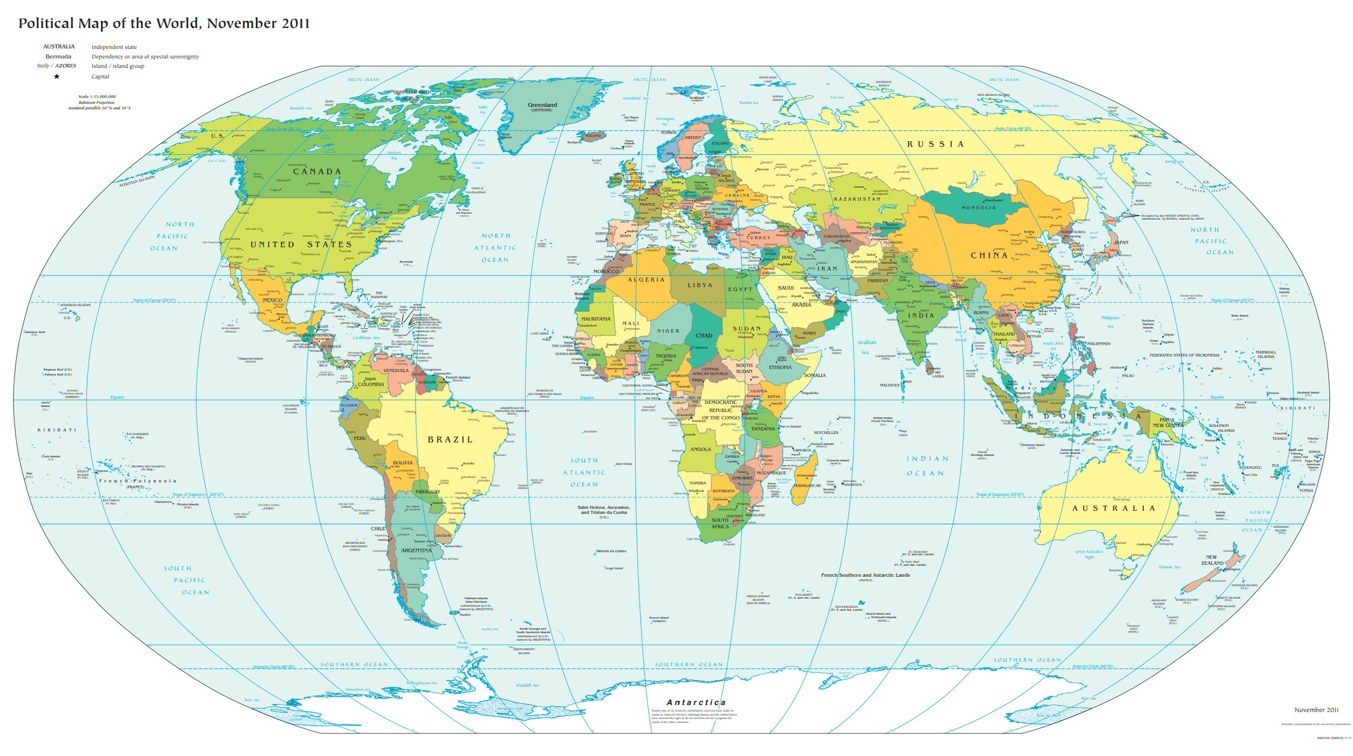
Political Map of the World, November 2011
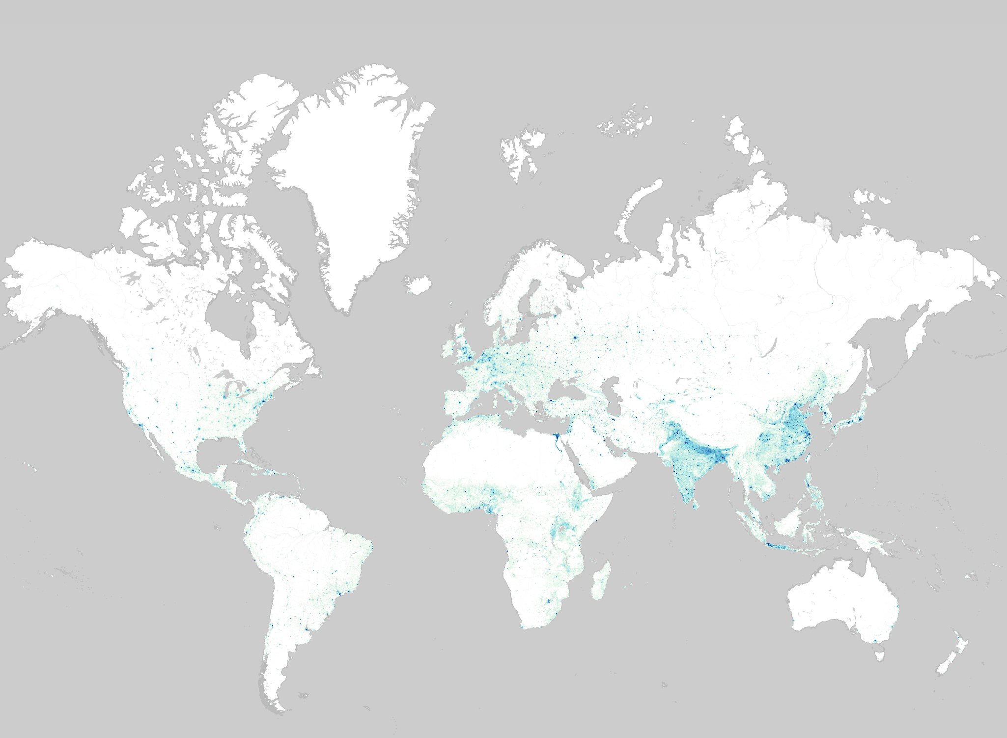
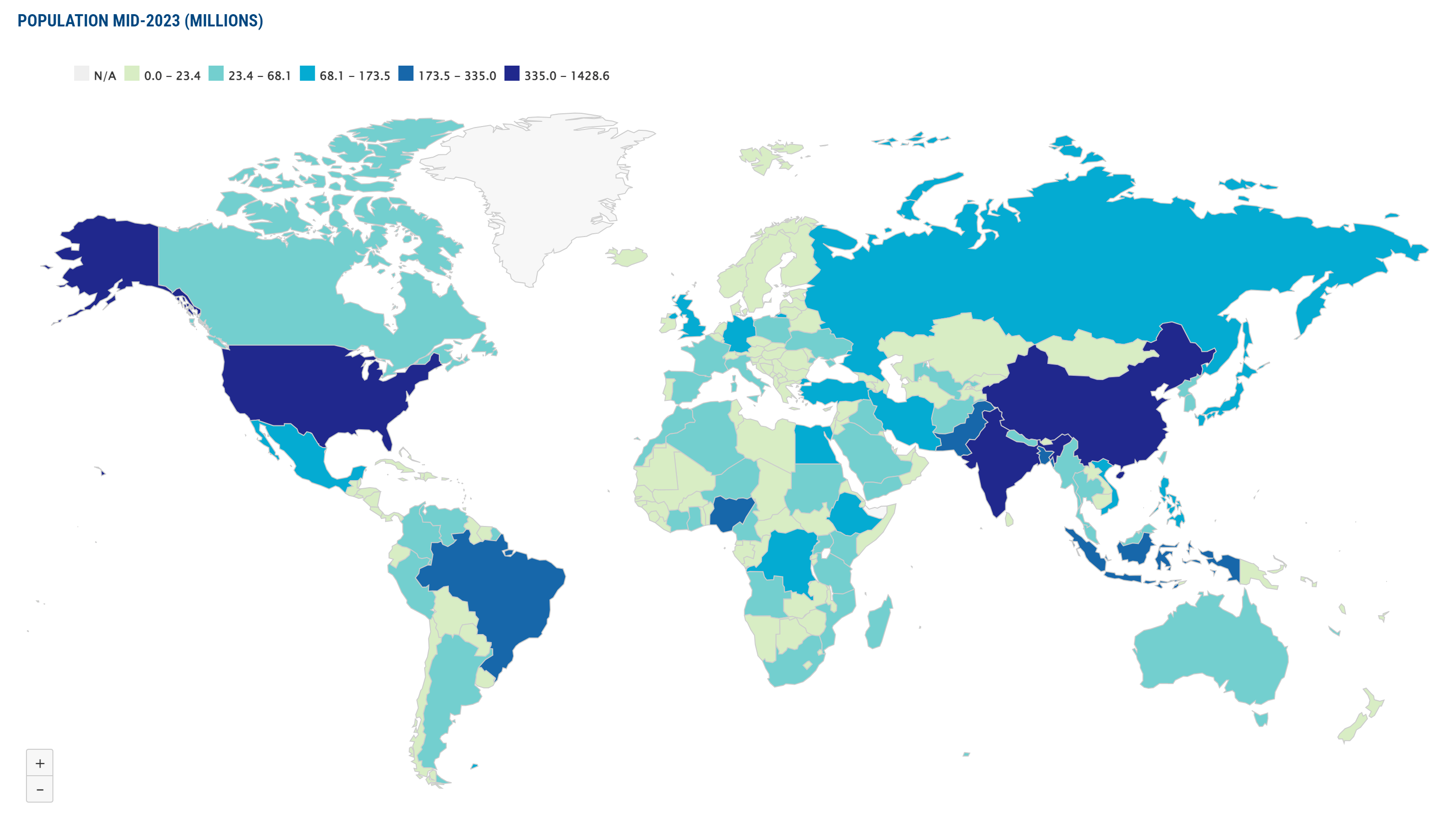
Population World Maps
Printable World Map with Countries’ Names
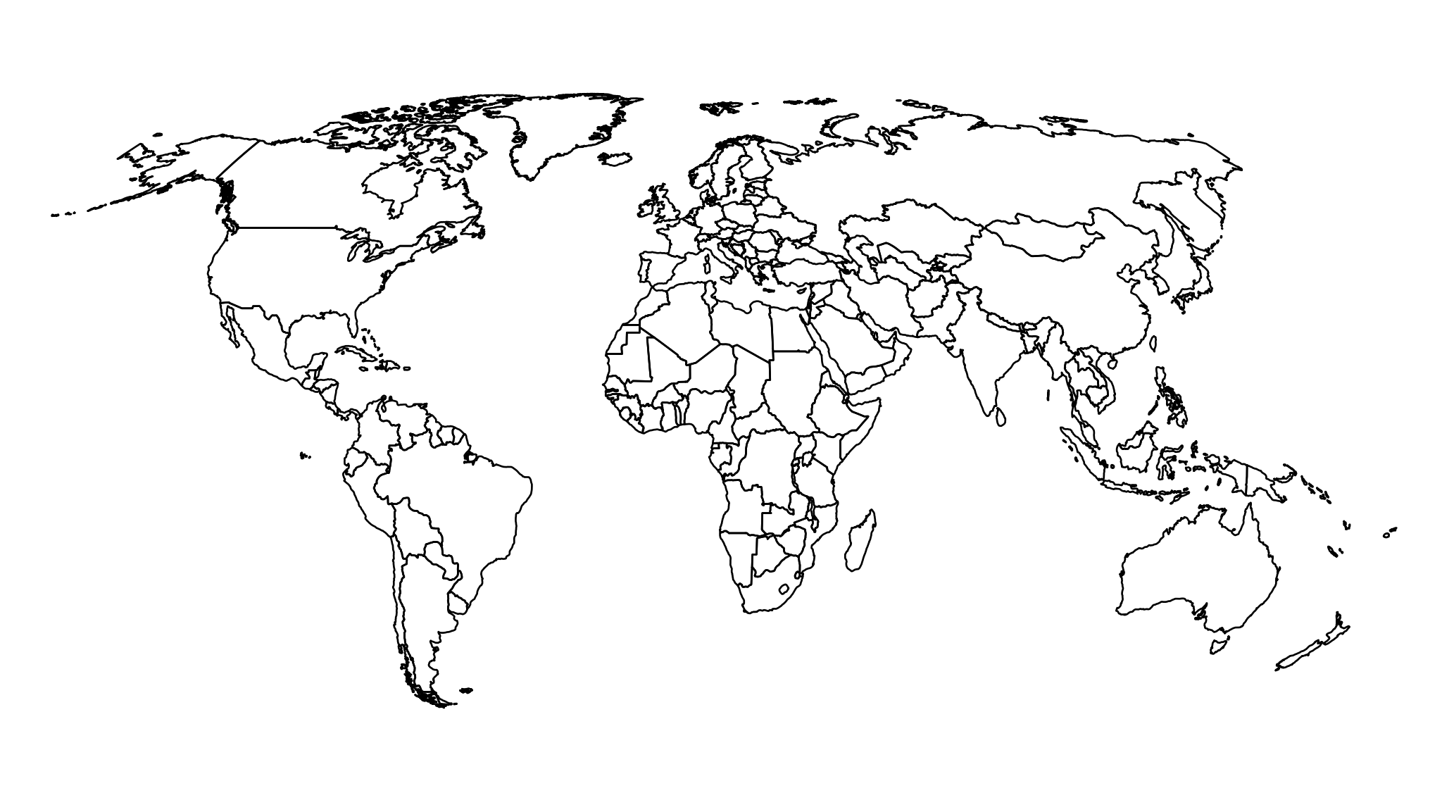
Blank Outline World Map
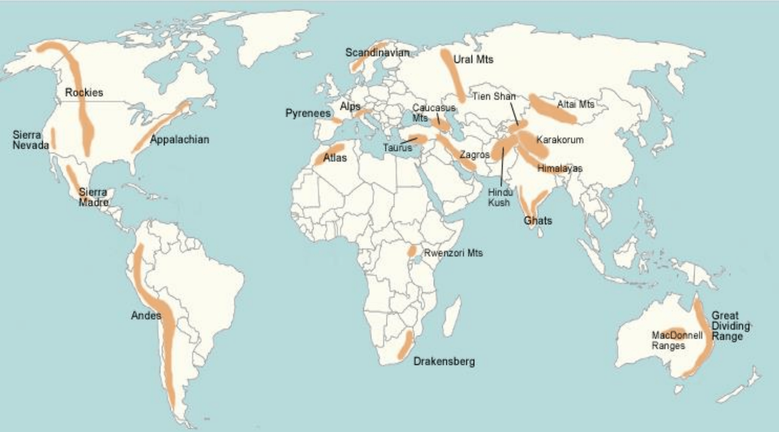
World Map with Major Mountain Ranges
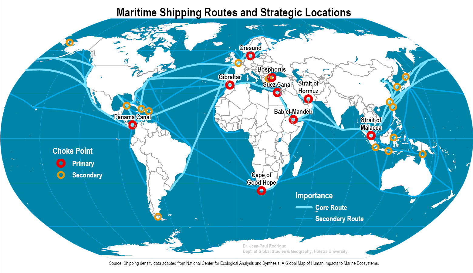
World Map with Major Maritime Shipping Routes
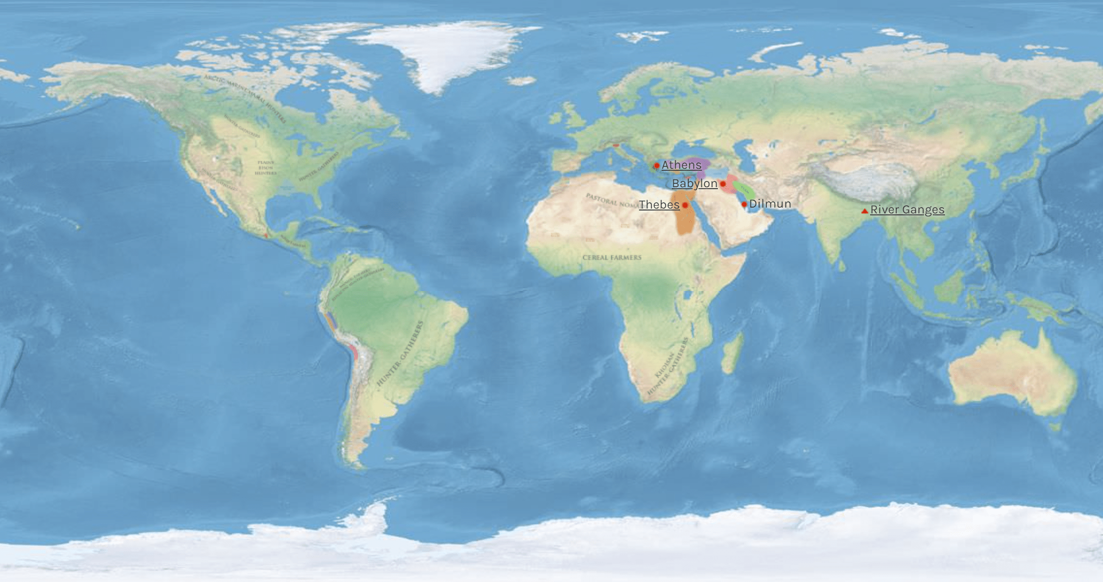
Ancient World Map