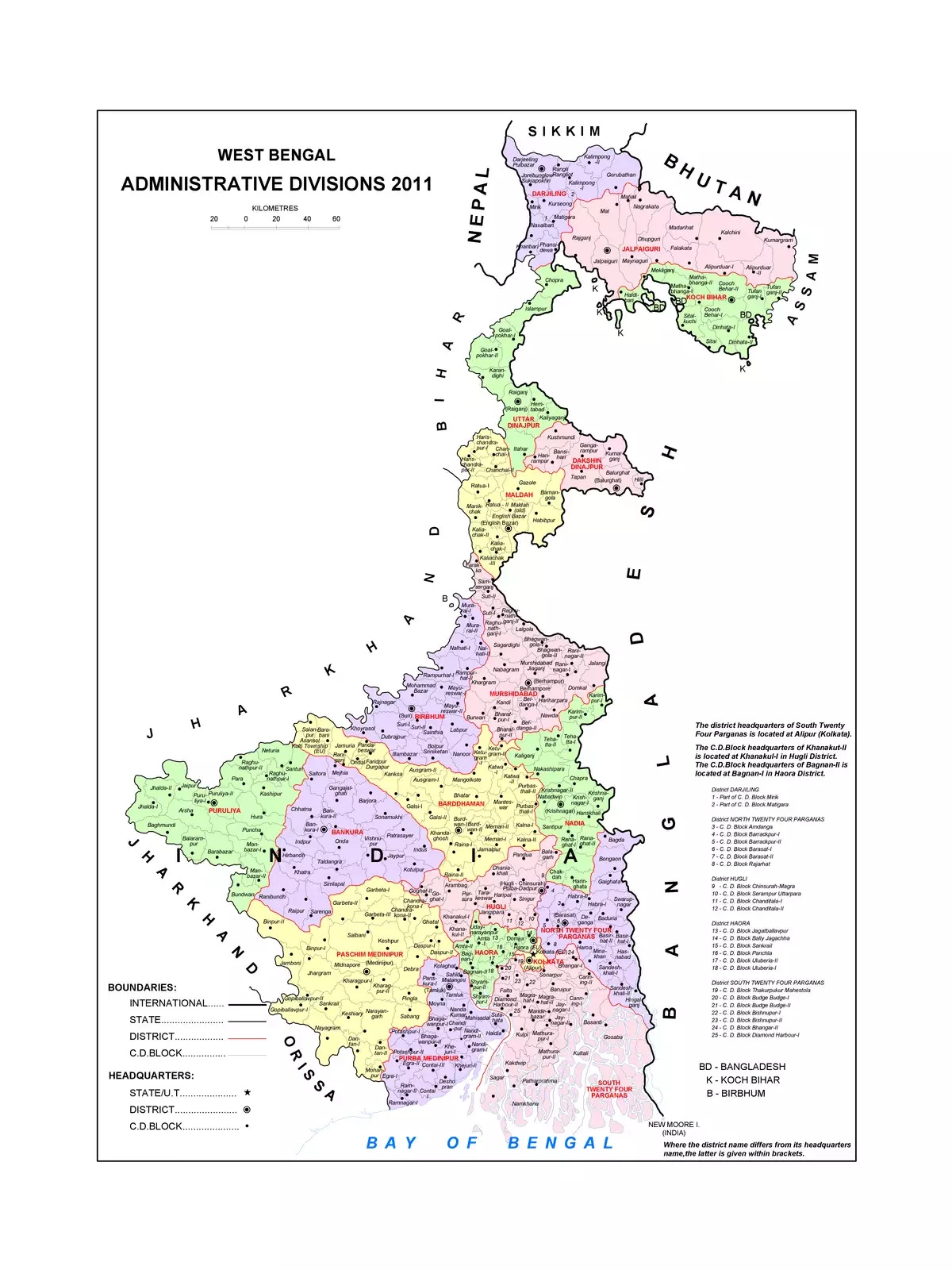
West Bengal District Wise Map
Discover the West Bengal District Wise Map, a valuable resource for anyone interested in this vibrant Indian state. West Bengal, located in eastern India, stretches from the Bay of Bengal in the south to the majestic Himalayan mountain ranges in the north. Kolkata, the capital and the largest city, serves as the cultural and economic heart of West Bengal. In Bengali, it is known as Paschim Banga, and the state spans an impressive area of 34,267.3 square miles (or 88,752 km²).
Explore the Districts of West Bengal
With its rich diversity, West Bengal has many districts, each with its unique charm and history. Understanding the district-wise map can help you appreciate the different regions, their culture, and geography.
Download the Map for Better Understanding
You can easily download the West Bengal Map in PDF format using the link given below.