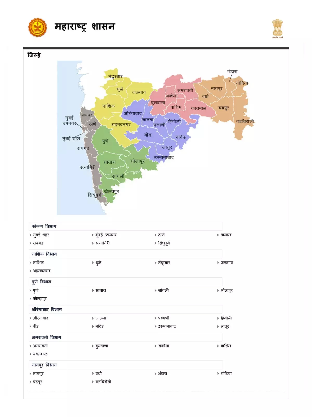
Maharashtra District Map
Maharashtra District Map is an essential tool for anyone eager to explore this colorful state in India. Situated in the western part of the country, Maharashtra stands as the third-largest state in India. It shares borders with Gujarat, Madhya Pradesh, Chhattisgarh, Telangana, Karnataka, Goa, and the Union Territory of Dadra and Nagar Haveli and Daman and Diu. The stunning Arabian Sea graces the western edge of the state, enhancing its geographical allure.
Explore the Maharashtra District
Maharashtra is famous for housing one of the largest film industries in the world, Bollywood, which plays a vital role in the country’s economy.
Exciting Places to Visit in Maharashtra District
There are countless exciting places to explore in Maharashtra. Some must-visit spots include Mahabaleshwar, Khandala, Panchgani, Lonavala, Matheran, the Ellora and Elephanta Caves, Chhatrapati Shivaji Terminus, and the UNESCO World Heritage Sites of Ajanta. Each of these attractions provides a unique experience, enriched with culture and breathtaking natural beauty.
When to Visit Maharashtra District
The monsoon season is one of the best times to discover the hilly areas of this state, like Mahabaleshwar, Toranmal, Lonavala, and Chikhaldara. However, if you wish to steer clear of the rains, the ideal time to visit is from October to March.
Don’t miss out! Download the updated Maharashtra District Map in PDF format using the link below to learn more about this magnificent state! 🌟