Karnataka Map with Districts and Taluks
Karnataka Map – Explore Karnataka state, situated in the southwestern region of India. This vibrant state shares its borders with Maharashtra to the North, Telangana to the Northeast, Andhra Pradesh to the East, Tamil Nadu to the Southeast, Kerala to the South, and the Arabian Sea to the West, along with Goa to the Northwest.
Karnataka spans a total land area of 191,967 square kilometers, which is about 5.83 percent of the total land area of India. Being the sixth largest state by area and the eighth largest by population in India, Karnataka is truly significant in size and diversity.
Karnataka State Quick Facts
Important Information
Date of formation: 01-11-1956
Area: 191,976 km2 (74,122 mi2)
Capital: Bengaluru
Population: 61,130,704 (2011)
Density: 319/km2
Males: 31,057,742 (2011)
Females: 30,072,962 (2011)
Sex ratio: 968 Females / 1000 Males
Official Language: Kannada
Literacy Rate: 75.36%
Number of Districts: 30
Number of Assembly Constituencies: 224
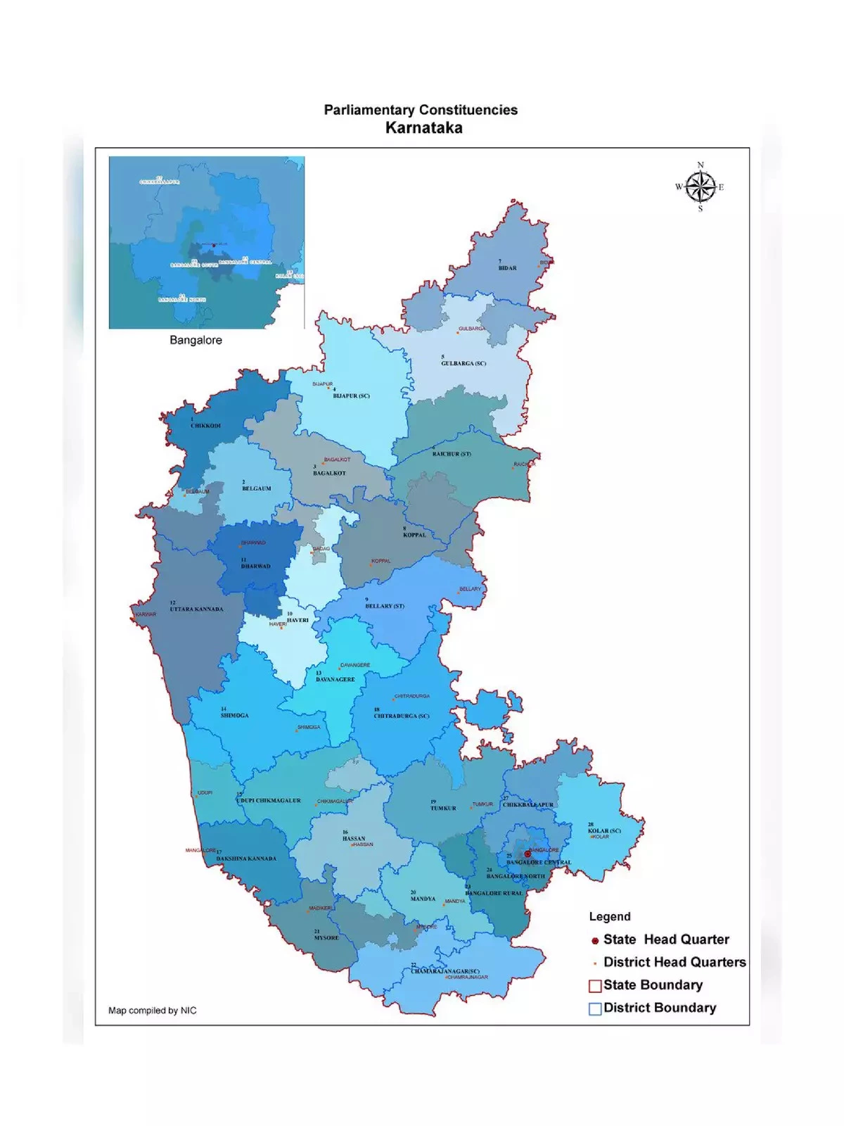
Number of Parliamentary Constituencies: 28
Main Rivers: Krishna, Tungabhadra, Sharavathi, Kaveri, Kabani
State Animal: Elephant
State Bird: Indian Roller
State Flower: Lotus
Official Website: www.karnataka.gov.in
Karnataka Map Districts List
Discover the 30 districts of Karnataka. You can download a detailed map to learn more!
- Bagalkote
- Bangalore Rural
- Bangalore Urban
- Belgaum
- Ballari
- Bidar
- Chamarajanagar
- Chikkaballapur[67]
- Chikkamagaluru
- Chitradurga
- Dakshina Kannada
- Davanagere
- Dharwad
- Gadag
- Gulbarga
- Hassan
- Haveri
- Kodagu
- Kolar
- Koppal
- Mandya
- Mysore
- Raichur
- Ramanagara[67]
- Shimoga
- Tumakuru
- Udupi
- Uttara Kannada
- Vijayapur
- Yadgir
Karnataka features a well-connected road network, consisting of 3,973 kilometers of National highways, 9,829 kilometers of State highways, and many kilometers of additional roads.
Use these resources to explore Karnataka’s geography effectively! 🚗