India Physical Map for Practice
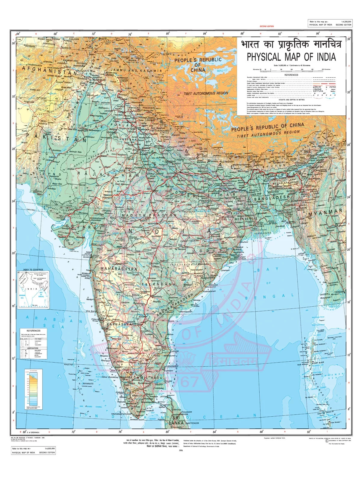
A physical map of India is always a helpful guide for students, tutors, and parents. They can download this map as a printable or offline version and use it for map-pointing purposes. This will help them enhance their knowledge about the physical features of India. With the help of the Indian physical map, they can easily locate the following areas or physiographic regions in the country:
- The Himalayan Mountain Range (the highest range of mountains in the globe)
- The Indian Peninsula
- The Indo-Gangetic Plains
- The Great Indian Thar Desert
- The Western and Eastern Ghat Mountain Ranges
- The Karakoram Mountain Range
Physical Map of India
A physical map of India shows all the physiographic regions of the nation. In terms of physiography, the country can be listed in the following regions:
- The Islands
- Coastal Plains
- The Peninsular Plateau
- The Great Indian Desert
- Northern Plains or Indo-Gangetic Plains
- The Himalayan Mountain Ranges or Northern Mountains
This map also highlights the prominent rivers and streams of the country such as the Yamuna, Ganga, Sutlej, Jhelum, Indus, and Godavari. The user-friendly map also has a scale that you can use to measure the elevation of the different areas throughout the nation.