Metro Map Hyderabad HD
The Hyderabad Metro Rail (HMR) Project is an integrated urban transport development project with inter-modal connectivity and convenient skywalks that will mark the beginning of an era of seamless commuting across Hyderabad.
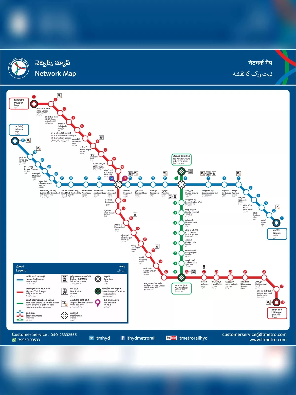
Metro Map Hyderabad (Hyd Metro Map)
- Red Line (Line 1):
- The Red Line runs from Miyapur to LB Nagar.
- It covers a distance of approximately 29 kilometers.
- Major stations on this line include Ameerpet, Begumpet, Punjagutta, and Parade Grounds.
- Blue Line (Line 2):
- The Blue Line runs from Nagole to Raidurg.
- It spans around 28 kilometers.
- Key stations on this line include Uppal, Tarnaka, Secunderabad East, and HITEC City.
- Green Line (Line 3):
- The Green Line connects JBS (Jubilee Bus Station) to MGBS (Mahatma Gandhi Bus Station).
- It is approximately 11 kilometers long.
- Important stations on this line include MG Bus Station, Victoria Memorial, and Parade Grounds.