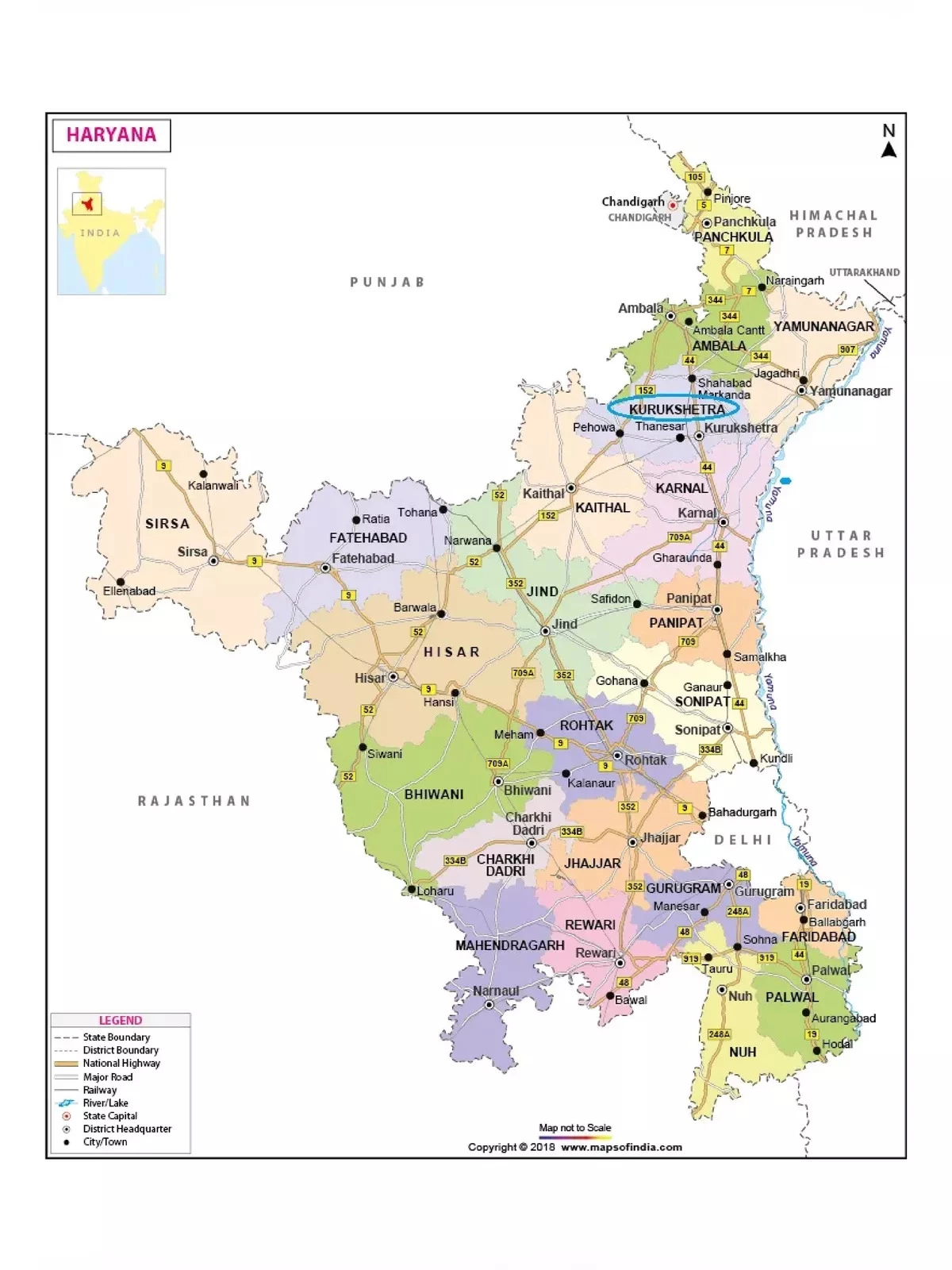
Haryana Map with Districts
Explore the comprehensive Haryana Map, showcasing major roads, railways, rivers, and national highways. Haryana is a vibrant state in Northern India, bordered by Rajasthan to the south and west, Himachal Pradesh and Punjab to the north, and Delhi to the east. The state’s location makes it a crucial link within the National Capital Region, surrounded by Delhi on three sides, including the northern, western, and southern borders.
Districts of Haryana
Haryana consists of several districts, including:
- Ambala
- Bhiwani
- Charkhi Dadri
- Faridabad
- Fatehabad
- Gurugram (Gurgaon)
- Hisar
- Jhajjar
- Jind
- Kaithal
- Karnal
- Kurukshetra
- Mahendragarh
- Nuh
- Palwal
- Panchkula
- Panipat
- Rewari
- Rohtak
- Sirsa
- Sonipat
- Yamunanagar
The Yamuna River forms the eastern border of Haryana with Uttarakhand and Uttar Pradesh, playing a vital role in the region’s geography.
Download the Haryana Map PDF
You can download the Haryana Map PDF using the link given below. This map is an excellent resource for understanding the geography and major highlights of Haryana!