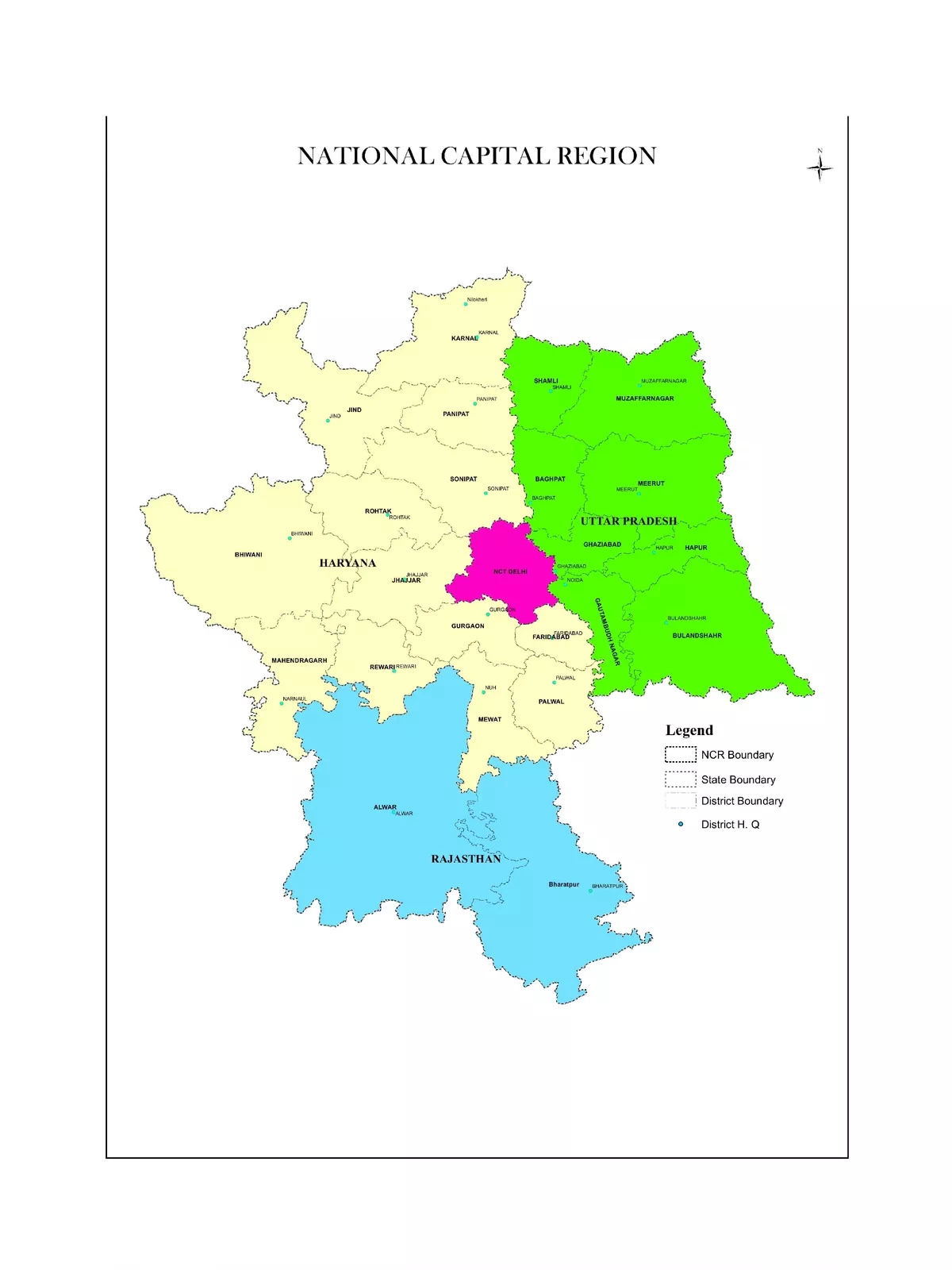
Delhi NCR Map District Wise
Delhi NCR (National Capital Region) HD Map PDF is available for download from the link provided at the bottom of this page. The Delhi NCR region is a bustling metropolis that encompasses not only Delhi but also neighboring urban areas in Haryana, Uttar Pradesh, and Rajasthan.
In this detailed Delhi NCR High Resolution Map PDF, you will discover the district-wise names of the states: Haryana, Rajasthan, Uttar Pradesh, and the various Zones within NCR. Currently, NCR is recognized as India’s largest and the world’s second-largest urban agglomeration, boasting a population of over 54 million people.
Delhi NCR Map HD District Wise
National Capital Territory of Delhi – This includes both Delhi and New Delhi.
Haryana – The districts included in the NCR are:
- Bhiwani
- Faridabad
- Gurgaon
- Jhajjar (Jhajjar and Bahadurgarh)
- Mahendragarh
- Panipat
- Rewari
- Rohtak
- Sonipat
- Mewat
- Palwal
- Jind
- Karnal
Uttar Pradesh – The districts included in the NCR are:
- Baghpat
- Bulandshahr
- Gautam Buddha Nagar District (Noida and Greater Noida)
- Ghaziabad
- Muzaffarnagar
- Meerut
- Hapur
Rajasthan – The districts included in the NCR are:
- Alwar
- Bharatpur
Zones of NCR
NCT-Delhi has an area of approximately 1,483 sq km, while Central NCR (CNCR) covers around 2,000 sq km.
The following suburbs are part of NCR:
- Faridabad-Ballabgarh Complex
- Ghaziabad-Loni-Bulandshahr Complex
- Gurgaon-Manesar Complex
- Noida-Greater Noida Complex
- Sonipat-Bahadurgarh Complex
- Sonipat-Kundli Complex
Download the Delhi NCR Map
You can easily download the Delhi NCR Map PDF using the link provided below. Enjoy exploring this vibrant region! 🗺️