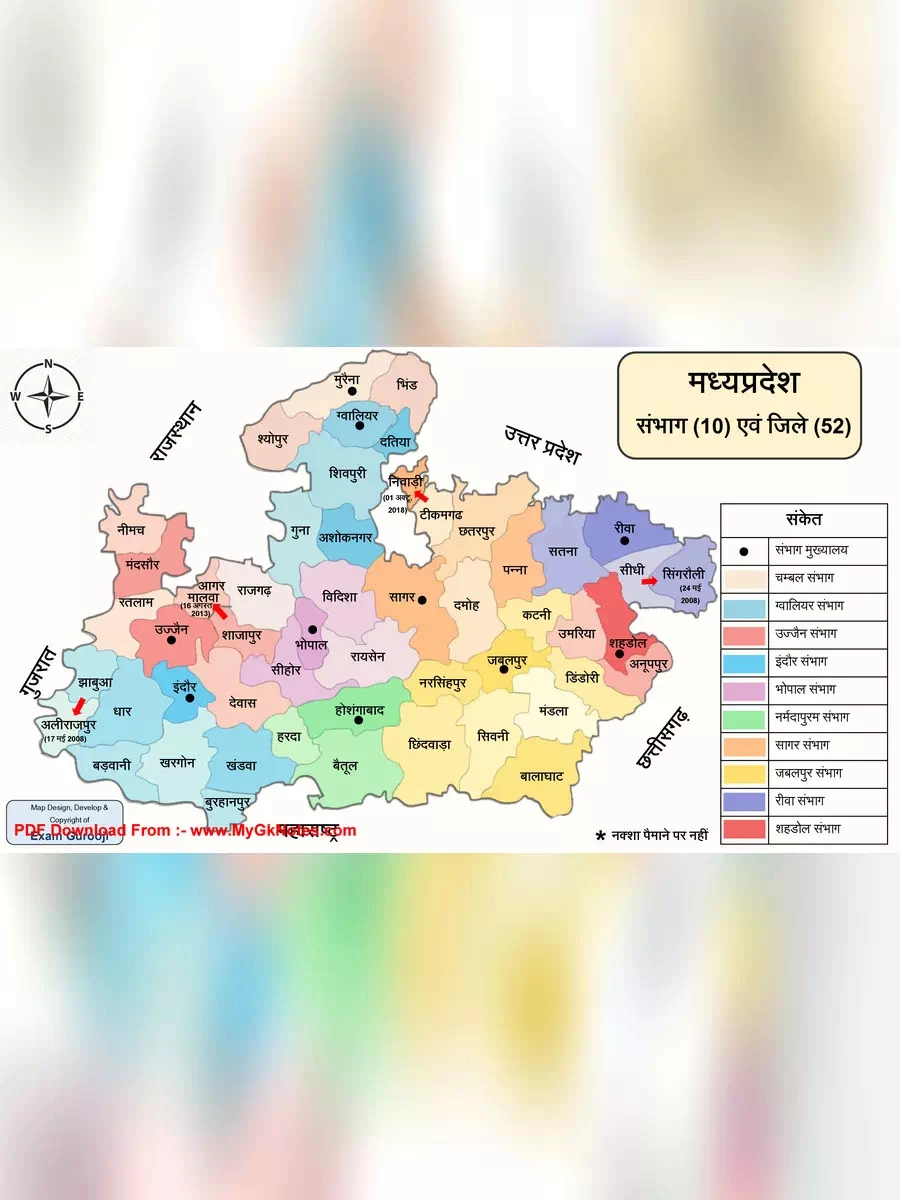
Madhya Pradesh (MP) Map
Madhya Pradesh, referred to as the “Heart of India”, is the second largest state in the country and is famous for its central location. This beautiful state is bordered by Rajasthan, Chhattisgarh, Uttar Pradesh, Maharashtra, and Gujarat.
Bhopal proudly serves as the capital of Madhya Pradesh, while Indore is known as its largest city. Historically, Madhya Pradesh has seen the rule of many influential dynasties, such as the Mauryans, the Mughals, and the Marathas. By the start of the 18th century, Madhya Pradesh was split into several small kingdoms, which were later taken over by the British and included in the Central Provinces and Berar, along with the Central India Agency.
The state’s population is 72,567,565 according to the 2011 census, and it spans an impressive area of 308,252 square kilometers.
Download the Madhya Pradesh Map
You can easily download the Madhya Pradesh Map in PDF format using the link given below.
Explore More About Madhya Pradesh
Madhya Pradesh is not just rich in history but also in culture and natural beauty. From stunning landscapes to historical sites, there is so much to explore in this state!