India Map with Latitude and Longitude HD
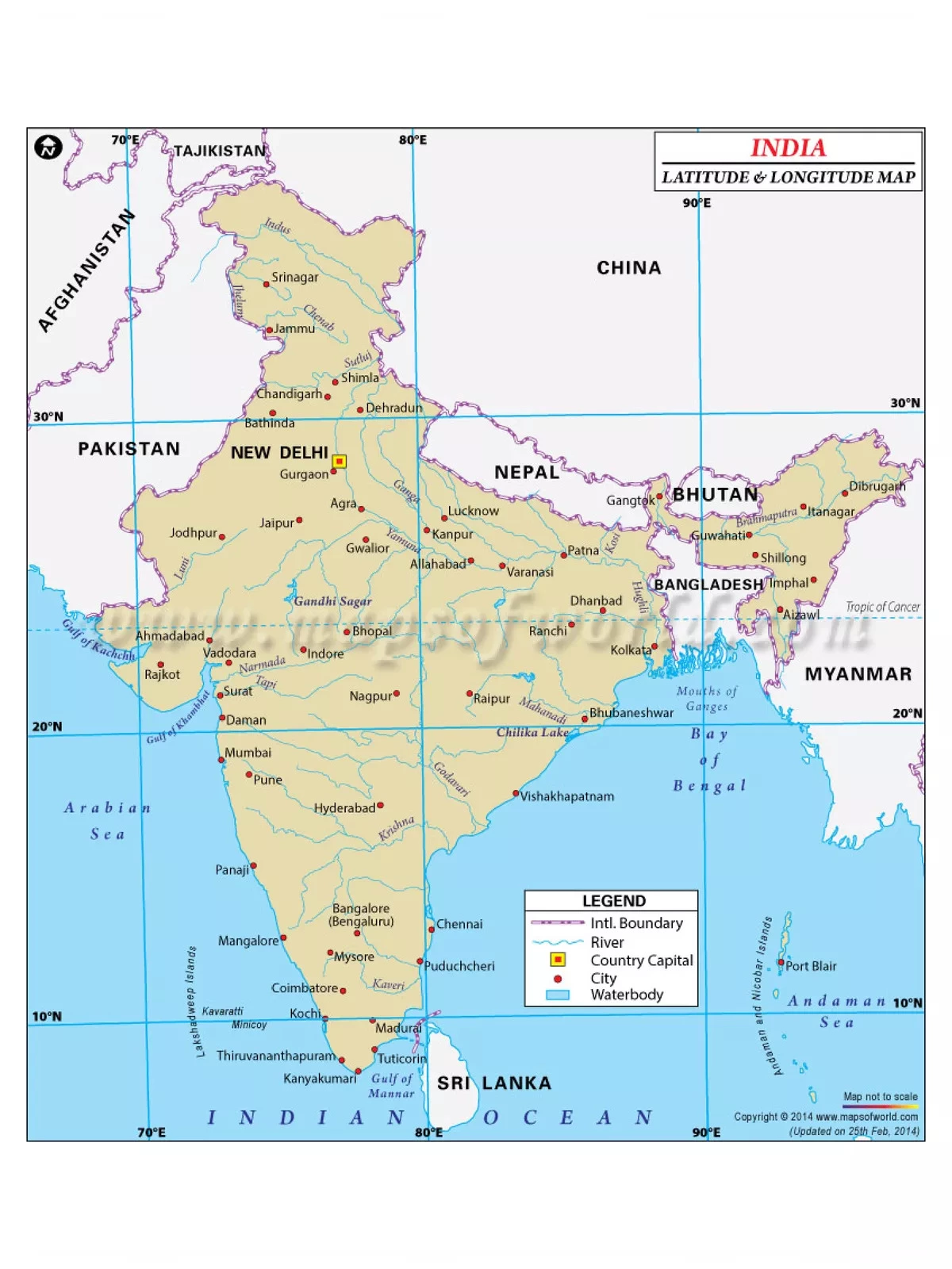
India is the seventh largest country in the world and ranks second in population. Surrounded by Bangladesh, Burma, Bhutan, China, Nepal, and Pakistan, India spans an impressive area of 3,287,590 sq km. The latitude and longitude of India, which are 20° North and 77° East respectively, help you locate this beautiful nation on the globe.
Exploring India: Geography and Borders
India is a vast and diverse country. It lies entirely in the Northern Hemisphere, extending between latitudes 8°4’N and 37°6’N and longitudes 68°7’E and 97°25’E. From the Bay of Bengal to the Arabian Sea and the Indian Ocean, India boasts a coastline of over 7,000 km. With 28 states and 8 Union Territories, it is rich in culture and tradition. Some of the most popular metropolitan cities include Mumbai, Kolkata, Delhi, Chennai, and Bangalore.
India Map with Latitude and Longitude
- India is divided into 28 states (further subdivided into districts) and 8 Union Territories, which include the National Capital Territory of Delhi. The country’s borders stretch a total length of 15,200 km (9,400 mi).
- Longitude is a measure of distance from the prime meridian, moving eastward (longitudes to the west are negative). Latitude measures how far north or south a location is from the equator (latitudes to the south are negative). In summary, India lies between 8°4′ to 37°6′ North latitudes and 68°7′ to 97°25′ East longitudes.
You can easily download the India Map with Latitude and Longitude PDF using the link given below.