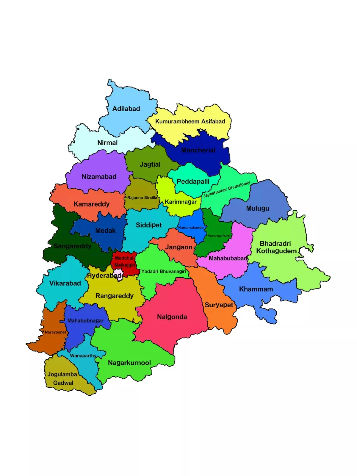
Telangana Map with Districts
Telangana Map with Districts showcases the 33 districts of Telangana State, which spans an area of 1,12,077 sq. km (44,273 sq. mi). The largest district here is Bhadradri Kothagudem, while Hyderabad holds the title of the smallest district. Telangana was formed by passing the AP State Reorganization Bill in both houses of Parliament. This vibrant State is bordered by Maharashtra and Chhattisgarh to the North, Karnataka to the West, and Andhra Pradesh to the South and East.
History and Major Cities
The Telangana region was a part of the Hyderabad state from 17th September 1948 until 1st November 1956 when it merged with Andhra State to create Andhra Pradesh. Some of the major cities in Telangana include Hyderabad, Warangal, Nizamabad, Nalgonda, Khammam, and Karimnagar.
Telangana Map with Districts – 33 Districts Name
| Adilabad |
| Bhadradri Kothagudem |
| Hanumakonda |
| Hyderabad |
| Jagtial |
| Jangaon |
| Jayashankar Bhupalpally |
| Jogulamba Gadwal |
| Kamareddy |
| Karimnagar |
| Khammam |
| Kumuram Bheem |
| Mahabubabad |
| Mahabubnagar |
| Mancherial |
| Medak |
| Medchal-Malkajgiri |
| Mulugu |
| Nagarkurnool |
| Nalgonda |
| Narayanpet |
| Nirmal |
| Nizamabad |
| Peddapalli |
| Rajanna Sircilla |
| Rangareddy |
| Sangareddy |
| Siddipet |
| Suryapet |
| Vikarabad |
| Wanaparthy |
| Warangal |
| Yadadri Bhuvanagiri |
You can easily download the Telangana Map with Districts PDF using the link provided below.